Newmarket council has officially decided to abandon a proposal to create a walking path that would connect Rita's Avenue to Yonge Street.
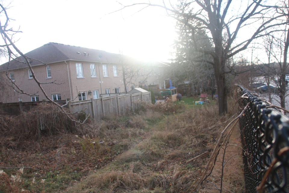
The original proposal had the path turn north off Rita's Avenue and run along a narrow strip of municipal land between a row of townhouses and the Ontario Superior Court of Justice parking lot. This would have brought the path very close to the backyards and doors of the townhouses.
The townhouse owners told council last week that they were worried about safety and privacy. The residents' spokesperson, Melanie Bell, also made a suggestion to the council that they would be willing to buy the land behind their homes from the municipality.
"For over 13 years, we residents have been maintaining this land. Perhaps the Town of Newmarket would consider an option to sell or deed the homeowners this parcel of land. Question mark, question mark, question mark," posed Bell to council last week.
At their meeting today, council opted instead for an alternative route that will cut across George Luesby Park, down to Clearmeadow Boulevard and out to Yonge.
There are no plans to sell the land to the townhouse owners or anyone else. Councillor Victor Woodhouse argued strongly that the property be kept in municipal hands and considered for future use to benefit the community. He also said he did not find the homeowners' objections to the path particularly convincing.
"While I understand the residents who would have this path behind their houses, to me, this is not a significant imposition. There are many other homes with paths behind where people are walking all the time," said Woodhouse.
"The purpose of a sidewalk, path or trail is for the greater good of the community. The trail does not operate for the individual who owns the home in front of or behind it."
Development and infrastructure commissioner Peter Noehammer explained although Monday's decision means the walking path to Yonge will be built elsewhere, it doesn't mean the town can't use the property for something else in the future.
He noted one possibility is the creation of a new road that would connect from Yonge to McCaffery Road or Eagle Street. This road would serve a potential intensified block neighbourhood built where the superior court building and its parking lot now stand.
"This is something that could potentially happen in the longer term. These lands wouldn't be big enough to form the entire local road, but a portion of it could be added to other lands coming from the block to form a southerly boulevard or buffer for residents," said Noehammer.
"So the intention is to maintain the lands in public ownership, at least for the time being, with that in mind."

