ENVIRONMENT CANADA
*************************
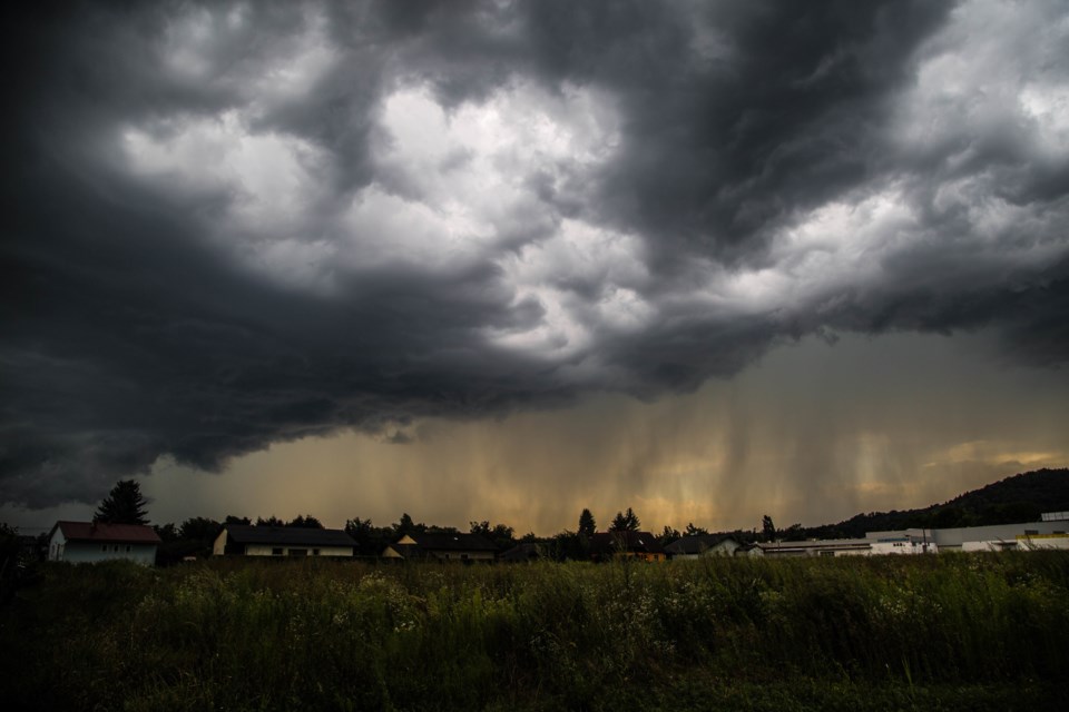
Severe thunderstorm watch in effect for:
- Newmarket - Georgina - Northern York Region
- Vaughan - Richmond Hill - Markham
Conditions are favourable for the development of severe thunderstorms that may be capable of producing large hail.
Isolated strong to severe thunderstorms are expected to move rapidly southeastward across portions of the GTA during the mid to late evening hours.
The storms may contain 2 to 4 cm hail and wind gusts of 80 km/h. Brief but torrential wind swept downpours and frequent lightning may also be associated with some of these storms.
There is a slight risk for an isolated tornado.
Large hail can damage property and cause injury. Strong wind gusts can toss loose objects, damage weak buildings, break branches off trees and overturn large vehicles. Remember, severe thunderstorms can produce tornadoes. Lightning kills and injures Canadians every year. Remember, when thunder roars, go indoors!
Severe thunderstorm watches are issued when atmospheric conditions are favourable for the development of thunderstorms that could produce one or more of the following: large hail, damaging winds, torrential rainfall.
The Office of the Fire Marshal and Emergency Management recommends that you take cover immediately if threatening weather approaches.
Please continue to monitor alerts and forecasts issued by Environment Canada. To report severe weather, send an email to [email protected] or tweet reports using #ONStorm.
For more information: http://www.emergencymanagementontario.ca/english/beprepared/beprepared.html.


