This is part two in my series on historic hamlets, highlighting those in the former Township of Whitchurch, which includes present-day Newmarket.
I'll start with a little background on the Township of Whitchurch to put things into perspective. Archeology has unveiled that the area we call Whitchurch was occupied from at least as early as the late 16th century. Before then, the northern Iroquoian settlement now known as the Jean-Baptiste Lainé Site was home to approximately 2,000 ancestral Wendat. Our ancestors told of at least three Indigenous trail systems in use when they arrived.
Records show that the Mississauga held claim to portions of Whitchurch dating back to a period long before our first settlers took up residence in the township and that in 1923 Whitchurch was included as part of the Williams Treaties.
Whitchurch Township was originally 59,743 acres (24,178 hectares) in size and was named around 1798 by colonel John Graves Simcoe, after the birthplace of his wife in Whitchurch, Herefordshire, England. The original boundaries were present-day Davis Drive, Yonge Street, the Stouffville Road and Durham Regional Road 30.
The Baldwin Act created the Township of Whitchurch as an organized municipal government in 1850. While most would maintain their names, existing hamlets were often absorbed into this newly formed township. The inaugural meeting of the municipal government of the Township of Whitchurch was held at Smith’s Inn in Stouffville on Jan. 6, 1851.
Three of these hamlets would later grow into villages and be separated from Whitchurch Township for administrative purposes, forming their own municipal governments in the following years. They were Newmarket (1858), Aurora (1863) and Stouffville (1877). In 1967, boundary changes took place that ultimately resulted in the creation of the Regional Municipality of York on Jan. 1, 1971, and the 14 existing municipalities were amalgamated into nine.
The township itself was created as part of the subdivision of York County, itself a subdivision of the original Home District. The story that we were taught at school was that the lands were originally acquired by the British in an agreement with the Mississaugas, known as the Toronto Purchase; it was enacted in British Parliament as the Toronto Purchase Act in 1787.
Acquisition of the lands for the townships of Etobicoke, King, Vaughan and York, Upper Canada was completed at a meeting between the Mississaugas and the British at the Credit River on Aug. 1, 1805, where 250,808 acres (1,014.98 km2) were exchanged for about £1,700. This narrative is being ‘re-edited’ as we speak.
Let us return our attention to a further examination of the hamlets of Whitchurch. The community of Island Lake is located at the corner of Durham Regional Road 30 and Aurora Road and consists of a kettle lake with its own island, from which the community got its name. Farmers were attracted to this area for the good land, fine timber and availability of ice harvested in the winter. By 1861, a steam-powered sawmill was on the northwest corner of the lake.
At McCowan Road, north of Aurora Road, the road ends at a deep gully. This is the old hamlet of Seldom Seen. It was not settled until after the 1860s. Even in present day, there is still no exit north from McCowan because of the deep ravine. It is said that this bridge may have been destroyed during Hurricane Hazel in October 1954.
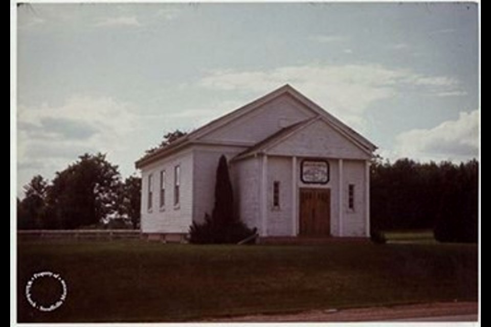
The community of Locust Hill was located on Highway 7 near the eastern boundary of what is now Markham. Locust Hill was established in 1885, a bustling community that grew around the railway line, a common story back then. It is said to have drawn its name from the cluster of locust trees on a hill on William Armstrong’s farm. Today, it still remains, with a few businesses and some original buildings, including a church built in the early 1890s.
As we saw in part one of this series, quite often a community takes its name from early settlers who put down roots and the community grew up around them. Baker Hill was such a community, named after the Baker family who would settle in the area in about 1802. The community was located south of Bloomington Road on the west side of Highway 48. Interestingly, this small community was composed primarily of members of the Baptist Faith.
In this general area, we find the community of Ringwood, which was settled by the Fockler family in the late 1790s at the four corners of Markham Road and Stouffville Road. Nicknamed Circle City by the locals, the community straddled two townships: Markham and Whitchurch. A post office was established there in 1857 and was closed in 1975. As a child, I used to call the community Ringworm as my dog suffered from that affliction and I often confused the two words.
The town of Stouffville itself was initially a hamlet that grew, much like Newmarket, into a town. Stouffville got its name from Abraham Stauffer (Stouffer) who emigrated to the area in 1804. The community sprang up around the grist and sawmills he built between 1817 and 1824. By 1832, a post office, still active today, was established, along with a general store, blacksmith shop, tavern, drugstore and school. The area continued to grow and eventually required its own municipal government. Stouffville was incorporated as a village in 1877. My great grandmother’s family were Forsyths and came from this community, so I grew up knowing it well.
Let's turn to the Township of King. One of the facts few people remember is that the Quakers who were brought to the area by Timothy Rogers were settling within King Township. My Lundy relatives had King Township as their land grant location.
Before we examine the hamlets of King, let's review a little historical background on the township. Simcoe named King Township for John King (1759–1830), an English bureaucrat from 1794 to 1801. The first seven land patents were issued in 1797 and in 1801, to Timothy Rogers, a Loyalist from Vermont, who after having travelled Simcoe’s Road settled on an area on the western boundary immediately southwest of Newmarket. He applied for and received a grant for land totalling 40 farms, each of 200 acres (0.8 km2) in size. By February 1802, he had set out for King Township with the first group of settlers that included my ancestors for those 40 farms. A second group followed later that month.
Most of us have travelled through the hamlet of Snowball at Dufferin Street and Wellington Street West (17th Sideroad). Snowball takes its name from a Vaughan church that relocated there in 1891, with joints that were pegged with snow. Today, when you drive through it, you will notice a community of about 200 residents with a garden centre, sand and gravel yard, gas bar, doughnut shop and general store. If an historic hamlet has indeed survived, you will likely find that it will resemble Snowball, a mere pitstop along the journey to somewhere else.
The community of Strange was initially known as Williamstown and was located around Weston Road and the 15th Sideroad in King. In 1880 it was renamed after local MP Dr. Frederick William Strange, who endeared himself to the community by having a new post office built. Today there are few traces of the community except for a church, which is now a private residence, and two cemeteries.
The community of Armitage was originally a Quaker community established around 1804 south of Mulock Drive on Yonge Street. It drew its name from Amos Armitage, who was part of the first group of Quakers to arrive in the early 1800s. Armitage was in fact the first of King's settlements and it is now part of Newmarket. Once a flourishing community, little remains of it beyond a stone cairn and historical plaque.
The centrepiece of the community was a Friends Meeting House constructed around 1829, providing immediate competition to a previously established meeting house to the north on Yonge. It would be known as the Hicksite Church, built by an off-shoot Quaker group described as being far less strict, permitting music during their services. The building was demolished in 1942. A cemetery still exists.
The other main building in the community, Gamble’s Inn, hosted the first public meeting in King Township on March 6, 1809. At that time, there were only about 160 inhabitants in the entire township. Many of you will remember that the original post office remained there until the women’s shelter was built at Yonge and Savage.
Next week, we continue our exploration of historic hamlets in the Township of King.
Sources: Back in time: Exploring York Region’s historical hamlets by Adam Martin-Robbins; Self-guided driving tour: Hamlets of Whitchurch-Stouffville; Materials from the Whitchurch Stouffville Museum; The Hamlets of Whitchurch Website; The Hamlets – Everything Stouffville Website (Selected Photos); What's in a name? How York Region communities got their monikers by Ali Raza; Album of Oldies by Elizabeth McClure Gillham; Photo of Ringwood School House by I. Neufast; Photo of Seldon Seen Barn from promotional website
Newmarket resident Richard MacLeod — the History Hound — has been a local historian for more than 40 years. He writes a weekly feature about our town's history in partnership with Newmarket Today, conducts heritage lectures and walking tours of local interest, and leads local oral history interviews.
