NewmarketToday.ca brings you this regular feature about our town's history in partnership with Richard MacLeod, the History Hound, a local historian for more than 40 years. He conducts heritage lectures and walking tours of local interest, as well as leads local oral history interviews. You can contact the History Hound at [email protected] or visit him on his History Hound Facebook page.
Let’s take a look back at the development of Highway 9/Davis Drive and its vital role in the growth of the Town of Newmarket.
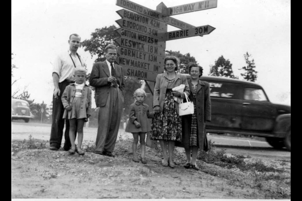
From the early decades of 1800, wagon trails on the township lines were used for access to Sharon to the east and Glenville to the west. With the arrival of the railroad, these routes became heavily travelled, bringing farm produce from the countryside to the rail centre here in Newmarket.
The merchants of Newmarket and farmers in the west part of King Township were anxious to have a passage cleared from what was then called Brownsville, now Schomberg, to Newmarket. There were, however, obstacles in the way — the river and marsh between concessions 6 and 8 of King and the steep hills found in the Glenville area that required a double team of horses to mount.
In 1856, several meetings were held in Newmarket and Brownsville to assess the problem and finally a resolution was found to form a stock company and sell shares to underwrite the costs of a survey and clearing of trees and brush.
However, years elapsed until 1892, when a road was cut through and gravelled from Concession 6 in King Township to Yonge Street. It was, however, a winter road that could be used only when the river and marsh were frozen. It was not until the 1930s that a practical crossing was actually constructed when the Holland Marsh was drained. The berm of the drainage canal was used as a roadway and bridges were constructed over the river.
In September 1936, the Province proposed a central highway from Lake Huron to Ottawa with a main segment, travelling from Orangeville to Peterborough and passing through Newmarket, utilizing Huron Street (now Davis). Huron was the town line, separating Whitchurch and East Gwillimbury townships and Newmarket.
At a meeting in Uxbridge Sept. 9, 1936, the idea was endorsed by representatives from all the municipalities along the route. Newmarket Mayor S.J. Boyd urged businessmen to take an active interest in the highway. The concept was shelved when Highway 401 was conceived as a trans-provincial highway and was then actually built in the late 1940s from Sarnia to Montreal, skirting the north part of Toronto. Thus, this potential bottleneck through Newmarket was temporarily averted.
Highway 400 was constructed from Toronto to Barrie in 1951 and bridged for overpass at the township line. In August 1958, the Newmarket Chamber of Commerce began an effort to persuade the Province to revive the idea of an east/west road from Orangeville to Uxbridge. Davis was widened and paved from Yonge to Main Street in 1950 with traffic lights installed at Yonge in November 1961.
In October 1963, it was announced Highway 9 would be extended nine miles from Highway 27, with a two-lane road to Newmarket, commencing in April 1965. Highway 404 had been in the planning stage since the 1960s, so this would be part of the overall scheme.
Construction of the new part of Highway 9 involved rebuilding the marsh road, also known as the Canal Road, with a diversion of the road at the Glenville hills and a levee to cross the old Glenville millpond. The cloverleaf at highways 400 and 9 was built in 1968. This was a major influence on the traffic flow into Newmarket from the west and was further accelerated by the extension of Davis eastward to Highway 48 when it was paved in 1975.
Construction of Highway 404, first envisioned in 1960, started in 1980 northward from Toronto between Leslie Street and Woodbine Avenue. The first segment was going to be to the Gormley Sideroad and then to the Bloomington Sideroad in 1982 and to the Aurora Sideroad in 1984.
Overpasses were made at Pleasantville and at Davis in 1987, but it was not until 1989 that it finally reached Davis. Approach and exit lanes were finished for the official opening Oct. 24, 1989. During 1991, the four lanes of Davis from Yonge to Highway 404 were reconstructed with curbing and shoulders added.
The impact of Highway 404 was to create enormous industrial and commercial growth, as well as residential growth, which resulted in a substantial traffic increase on Davis. This major problem was the underlying focus of the recently completed reconstruction of Davis, but the problem still remains even after this recent work.
The provincial government spent about $268 million on the reconstruction of Davis from Yonge Street to Hwy. 404. A 2.7-kilometre Viva rapidway from Yonge to Southlake Regional Health Centre was constructed, with pedestrian-friendly boulevards and open spaces. The four-year project was complete by mid-2016.
The extensive construction period became controversial, particularly as its impact left many businesses along the road struggling for survival.
The route required expropriation of land from 133 property owners, most involving “slivers” of land. As part of construction, two heritage buildings, the Union Hotel, at the corner of Main and Davis had to be moved back from the road.
Davis is now envisioned as a high-density urban area, with York Region and the Town planning for future growth of 33,000 people and 32,000 jobs along the Yonge and Davis corridors in the next few decades.
A general note: The name of Huron Street was changed in 1946 to Davis Drive, to honour the Davis family who operated a large leather tannery on the north side of the road, just west of the Holland River, from the early 20th century to the 1960s.


